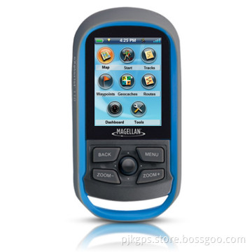


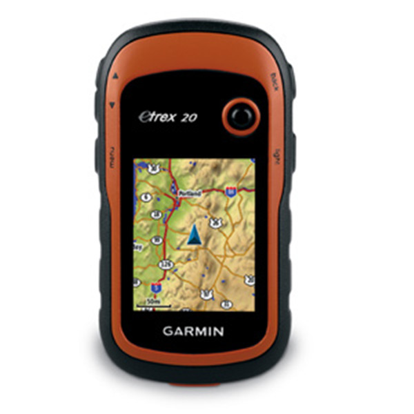
2014 Hot Selling Garmin Etrex10/20/30 Dakota20 Handheld GPS
- Payment Type:
- T/T, Western Union, Paypal, Money Gram
Quantity:
Your message must be between 20 to 2000 characters
Contact NowBasic Info
Basic Info
| Place of Origin: | USA |
|---|---|
| Payment Type: | T/T, Western Union, Paypal, Money Gram |
Product Description
Product Description
2014 hot selling Garmin etrex10/20/30 Dakota20 handheld GPS
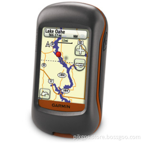
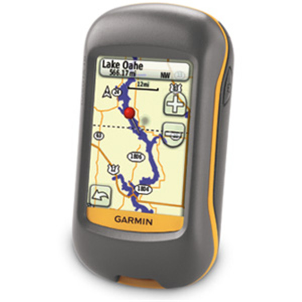
Outdoor navigation meets touchscreen simplicity in Dakota 20. This rugged, palmsized
navigator combines touchscreen navigation, high-sensitivity GPS with HotFix® satellite
prediction, barometric altimeter, 3-axis electronic compass and microSD™ card slot
in one affordable, power-packed punch.
Touch and Go
Dakota 20 makes outdoor navigation effortless with a tough, sunlight-readable,
2.6" (6.6 cm) color touchscreen display. The interface is easy to use, so you'll spend more time enjoying the outdoors and less time searching for information. Both durable and
waterproof, Dakota 20 is built to withstand the elements; bumps, dust, dirt and
water are no match for this rugged navigator.
Get Your Bearings
Dakota 20 has a built-in 3-axis electronic compass, which shows where you're heading even when you're standing still or not holding the device level. Its barometric altimeter tracks changes in pressure
to pinpoint your precise altitude, and you even can use it to plot barometric pressure over
time, which can help you keep an eye on changing weather conditions. And with its high-sensitivity, WAAS-enabled GPS receiver with HotFix satellite prediction, Dakota 20
locates your position quickly and precisely and maintains its GPS location even in heavy
cover and deep canyons.
Find Fun
Get into paperless geocaching with Dakota 20 by quickly downloading up to 2, 000 caches with information such as location, terrain, difficulty, hints and description — no more paper printouts and manually entered coordinates.
Explore the Terrain
Dakota 20 comes with a built-in worldwide basemap, so you can navigate anywhere with ease. Adding more maps is easy with our detailed topographic, marine and road maps, available on microSD™ card.
Share Wirelessly
Share your waypoints, tracks, routes and geocaches wirelessly with other compatible
Dakota, Foretrex®, Oregon® and Colorado® devices. Just touch "send" to transfer your
information to similar devices.
Get Connected
You've been busy exploring and now you want to store and analyze your activities. With a
simple connection to your computer and Internet, you can get a detailed analysis of your
activities and send tracks to your outdoor device using Garmin Connect™.
This one-stop site offers an activity table and allows you to view your activities on a map
using Google™ Earth. Explore other routes uploaded from more than 12 million
customers and share your experiences on Twitter® and Facebook®. Getting started is
easy, so get out there, explore and share.
Plan Your Next Trip
Take charge of your next adventure with BaseCamp™, software that lets you view and
organize maps, waypoints, routes, and tracks. This free trip-planning software even allows you to create Garmin Adventures that you can share
with friends, family or fellow explorers. BaseCamp displays topographic map data in 2-D
or 3-D on your computer screen, including contour lines and elevation profiles.
It also can transfer an unlimited amount of satellite images to your device when paired with a BirdsEye Satellite Imagery subscription.


Related Keywords
Related Keywords
You May Also Like
You May Also Like