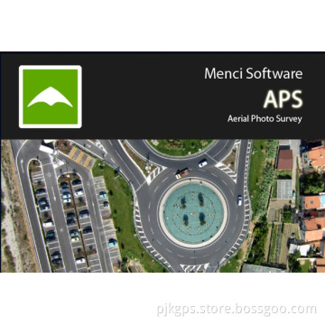
Menci Software Aps Aerial Photo Survey
- Payment Type:
- T/T, Paypal, Western Union
Quantity:
Your message must be between 20 to 2000 characters
Contact NowBasic Info
Basic Info
| Place of Origin: | Original |
|---|---|
| Payment Type: | T/T, Paypal, Western Union |
Product Description
Product Description
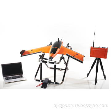
Menci software APS aerial photo survey
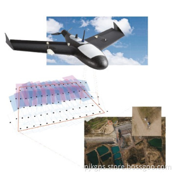
APS is the Menci Software technology for the DTM, contour lines, orthomosaic, DSM and 3D point cloud automatic generation from aerial imagery, acquired by any low-altitude UAV (unmanned aerial vehicles) with GPS on board.The simple and intuitive interface allows the user an immediate interaction with the features offered.The workflow, passing through the management of the dataset up to the generation of the DTM, contour lines , orthomosaic and DSM is easy to be followed. Furthermore APS lets the control over results to the user.The immediate low resolution raster (Overview) allows an easier identification of the AOI, as well as the ability to evaluate the extents of specific areas.
APS is the Menci Software technology for the DTM, contour lines, orthomosaic, DSM and 3D point cloud automatic generation from aerial imagery, acquired by any low-altitude UAV (unmanned aerial vehicles) with GPS on board.The simple and intuitive interface allows the user an immediate interaction with the features offered.The workflow, passing through the management of the dataset up to the generation of the DTM, contour lines , orthomosaic and DSM is easy to be followed. Furthermore APS lets the control over results to the user.The immediate low resolution raster (Overview) allows an easier identification of the AOI, as well as the ability to evaluate the extents of specific areas.

Related Keywords
Related Keywords
You May Also Like
You May Also Like